


FORT DODGE PCT 12, Webster County, Iowa
About
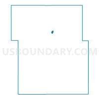
Outline

Summary
| Unique Area Identifier | 583681 |
| Name | FORT DODGE PCT 12 |
| County | Webster County |
| State | Iowa |
| Area (square miles) | 0.35 |
| Land Area (square miles) | 0.35 |
| Water Area (square miles) | 0.00 |
| % of Land Area | 100.00 |
| % of Water Area | 0.00 |
| Latitude of the Internal Point | 42.51411600 |
| Longtitude of the Internal Point | -94.17012390 |
Maps


Graphs
Select a template below for downloading or customizing gragh for FORT DODGE PCT 12, Webster County, Iowa


Neighbors
Neighoring Voting District (by Name) Neighboring Voting District on the Map
- FORT DODGE PCT 10, Webster County, IA
- FORT DODGE PCT 11, Webster County, IA
- FORT DODGE PCT 2, Webster County, IA
- FORT DODGE PCT 7, Webster County, IA